Fascinating new exhibition charts changes in Melton over the last 200 years


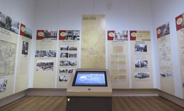
Visitors to the Thorpe End venue will get the chance to view maps going back to the late 18th century, interactive flip books and an interesting map animation film.
The centre piece of the exhibition is a reproduction of a stunning 1871 Lordship map, which was produced for the townsfolk and local lawyers of the day by local solicitor William Latham, who was born in 1800 and who was aged 71 when he created the map.Councillor Christine Radford, Leicestershire County Council’s cabinet member for adults and communities, said: “This fantastic exhibition gives people a chance to connect to the history of Melton Mowbray and explores how it has changed and evolved through time.“Volunteers have worked incredibly hard to bring this exhibition to life and I encourage everyone to visit and discover how Melton Mowbray became the town it is today.”Created as the definitive public record of the landowners and their tenants in 1871, the map includes notable buildings from the time, including the two breweries and the Melton Mowbray Union Workhouse.A detailed picture of the town in 1871 is also painted by the exhibition's interactive flip book, which features the markets, places to stay, notable residents of the town, the hunting and racing scene, schools and places of worship, landowners and William Latham himself.A team of six research volunteers, assisted by the museum staff, dedicated many hours of their time to research the town for the exhibition, scouring books, newspaper articles, the 1871 Census, 1870s’ trade directories and old images of the town to bring the exhibition to life.Display panels also highlight the small and large changes seen in the town with many of the maps coming from the county council’s Records Office.The short, animated map film, created through volunteering by the design team from Edmentum, shows the history of the town from Medieval times to the present day.Historic objects are also on display, along with modern maps from the mid-20th century for visitors to learn more about the area and about map making.
Wall maps are available for Melton Mowbray residents to mark where they live.
The exhibition runs until mid-December.