New book showcases walks along the Melton Navigation


The waterway followed the Rivers Wreake and Eye from the River Soar near Syston to a cargo basin close to where the Melton Borough Council offices are now. The basin was also the start of the 16-mile Oakham canal with The Boat Inn then operating as an attractive quayside pub.
It was a busy commercial route between 1797 and 1877 with horse-drawn barges bringing Derbyshire coal into the basin and agricultural produce, wood and manure being taken in the opposite direction for export to the rest of the country.
Advertisement
Advertisement
Melton and Oakham Waterways Society (MOWS), a charity formed in 1997 with the aim of restoring the Navigation, has published the new book of walks to encourage more people to discover the waterways which was Melton’s link to the national canal network throughout the 1800s.
The six walks along the Rivers Eye and Wreake follow, as closely as possible, the original route of the Navigation, from Melton Mowbray to Cossington, a distance of just over 16 miles.
MOWS committee member, Geof Malone, who compiled the book for the society said: “I’m hoping the book will help make more people aware of the Navigation’s history and what MOWS are doing to restore it and once again enable boats to sail into the centre of town.
“These are delightful walks through some beautiful countryside and lovely villages and there’s some fascinating history.”
Advertisement
Advertisement
The walks in the book are based on the original Wreake Valley Way route but they have been updated and expanded and now include information about the villages and other points of interest along the way.
Most of them take around a couple of hours for both the outward and return journey and some include a circular route.
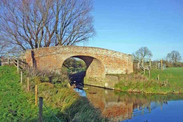
It is no longer possible to walk alongside the river all the way because, when the Navigation was abandoned in the late 19th century, the towpath – along which horses would pull cargo barges – reverted to private landowners. Most of the 12 original locks which were built to maintain water levels for mills and enable barges to travel uphill, can, however, still be seen, with some in remarkably good condition.
The walks featured are: Melton Mowbray to Eye Kettleby Lock; Eye Kettleby Lock to Kirby Bellars; Kirby Bellars to Frisby on the Wreake; Frisby on the Wreake to Hoby; Hoby to Thrussington or Ratcliffe on the Wreake; Ratcliffe on the Wreake to Three Way Bridge and the River Soar
Advertisement
Advertisement
The book contains details of how to get to the starting points (and return) either by car or bus and walks can be undertaken individually or linked together.
Costing £3.95, the 40-page book is currently available at Melton Sports in King Street, Melton; Grange Garden Centre at Asfordby Hill; Hilltop Farm shop, the Country Park cafe; Frisby post office; and will shortly be on sale in other outlets.